 FLASH SALE: EVERYTHING HALF PRICE! LIMITED TIME ONLY!
 Sale!
Sale! Backcountry Skiing Berthoud Pass Colorado
- $24.95
- $19.96
Author and founder of Front Range Ski Mountaineering (frontrangeskimo.com), Rob Writz, has put his breadth of knowledge and years of experience on Berthoud Pass into this one-of-a-kind guidebook.Since the 1930s, skiers have been exploring the peaks surroun
- 100% Happiness Backed or Your Money Back
- Free Delivery on 30+ Orders
- 60-Day Hassle-Free Returns
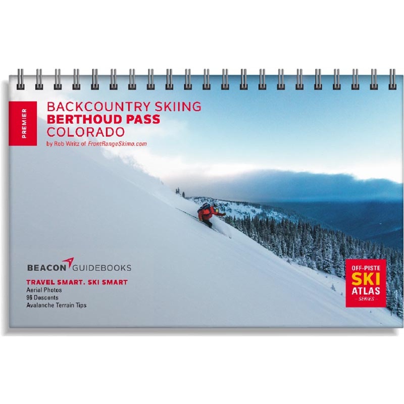
Author and founder of Front Range Ski Mountaineering (frontrangeskimo.com), Rob Writz, has put his breadth of knowledge and years of experience on Berthoud Pass into this one-of-a-kind guidebook.
Since the 1930s, skiers have been exploring the peaks surrounding US Highway 40 as it climbs and descends Berthoud Pass. The former home of one of Colorados pioneering ski areas, it has grown into one of the most popular backcountry ski destinations on the Front Range. The Berthoud Pass zone boasts big lines, mellow day tours and everything in between. Every skier can find suitable terrain for their experience and for the days avalanche forecast in this guidebook.
Youll find high-quality aerial photos marked with ascent and descent indicators, individual run descriptions, slope angles, aspect, Avalanche Terrain Exposure Scale ratings, parking and trailhead information and more in this lightweight book that can fit in your pack. Designed to go along with you on your tours and accompany the Backcountry Skiing Berthoud Pass Ski Map and Ski App. This is more than just a guidebook. Its a decision making tool.
This 5.5 x 8.5 spiral-bound book covers the following zones: Pumphouse Basin North & South, West Side, Mt. Russell, No Name, Floral Park, East Side, Hells Half Acre, Mines Peak, Lower 80s and 90s, Upper 80s and 90s, Hidden Knoll, Hidden Knoll South, 110s, Upper 110s, Second Creek Ridge East & West, Second Creek Ridge Headwall, and First Creek Ridge.
Cost:
$25
Free Shipping:
We offer free shipping on orders over $30. Please check the free - shipping eligibility at checkout.
Delivery Time:
It usually takes [3-5] business days for standard shipping. Please note that this is an estimated time frame and may be affected by local holidays, and unforeseen circumstances.


Reviews
There are no reviews yet.